• Home
  • Select your location
    • Camberley
      • Travel by bus
      • Travel by train
      • Travel by bike
      • Travel by foot
      • Travel by car
        • Car Share
        • Eco Driving
    • Bromley
      • Travel by bus
      • Travel by train
      • Travel by bike
      • Travel by foot
      • Travel by car
        • Car Share
        • Eco Driving
      • Travel by Thames Clipper
    • Chester
      • Travel by bus
      • Travel by train
      • Travel by bike
      • Travel by foot
      • Travel by car
        • Car Share
        • Eco Driving
    • King Edward Street
      • Travel by tube
      • Travel by foot
      • Travel by bike
      • Travel by bus
      • Travel by train
      • Use a car club
      • Travel using GUTSi
      • Travel by Thames Clipper
    • Canada Square
      • Travel by foot
      • Travel by bike
      • Travel by tube & DLR
      • Travel by train
      • Travel by bus
      • Travel by car
        • Use a car club
        • Eco driving
      • Travel using GUTSi
      • Travel by Thames Clipper
    • Central Park
      • Travel by Luas
      • Travel by Bus
      • Travel by Train
      • Travel by Bike
      • Travel by Foot
      • Travel by Car
        • Car Share
        • Eco Driving
  • About MyCommute
  • Request a PJP
  • Contact Us
  • Upcoming Events

Travel by tube

to King Edward Street

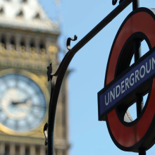
For many the London Underground is the most popular and convenient mode of public transport for commuting to and from work.

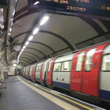
The nearest Tube station is St Pauls, which is on the Central Line.  A short walk away is Bank which is on the Central, Northern and Waterloo and City Lines.  Furthermore Bank is served by the Docklands Light Railway (DLR) making trips between the King Edward Street site and 5 Canada Square quick and convenient.

Find out more about catching the tube to King Edward Street

  • Tube map

    To view and download a tube map click here

    Alternatively you can use the interactive map byclicking here
  • Plan a journey by public transport

    You might also find it useful to use TfL’s excellent journey planner – you can put in your home location and times of travel and it gives you a range of travel options and up to the minute travel updates - click here

    If you are travelling from outside the TfL area (essentially beyond the M25) then you might find it more useful to use the Google Maps journey planning tool to plan your journey - click here
  • Paying for tube journeys

    Whilst you can buy single and day tickets for the Underground network from any station, the cheapest and most convenient way to pay is through the Oyster card scheme.

    For more information on Oyster Card options click here, where you can also register an Oyster online account. An online account allows you to receive weekly or monthly email statements and see your journey history for the last 8 weeks along with what you have paid.
  • Further useful links

    > Transport for London: Tube pages
    > TfLs Oyster pages
    > Live service updates

Let us help plan your journey

Request a Personal Journey Plan

King Edward Street MyCommute Pages

  • Travel options
    • Travel by tube
    • Travel by foot
    • Travel by bike
    • Travel by train
    • Travel by bus
    • Use a car club
    • Travel using GUTSi
    • Travel by Thames Clipper
    Site developed by Travel Plan Services Ltd